

-
×
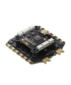 GEPRC TAKER H743 BT 8Bit 80A STACK
1 × $129.99
GEPRC TAKER H743 BT 8Bit 80A STACK
1 × $129.99 -
×
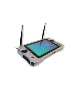 RE35 Smart Controller for Industrial Automation and IoT Drone Kit
1 × $1,628.00
RE35 Smart Controller for Industrial Automation and IoT Drone Kit
1 × $1,628.00 -
×
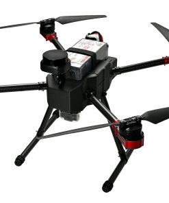 X4-900H Industrial Drone for Mapping and Inspection
1 × $42,880.00
X4-900H Industrial Drone for Mapping and Inspection
1 × $42,880.00
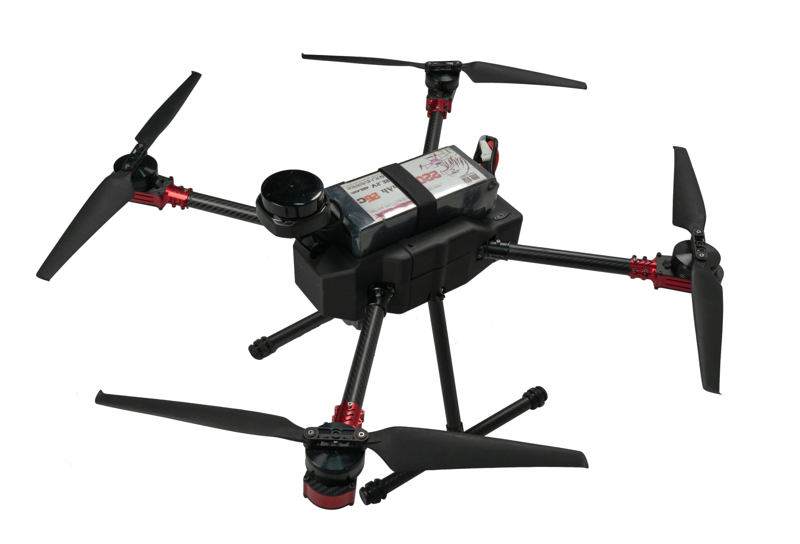

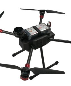
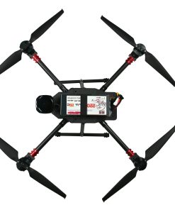
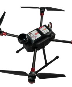
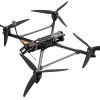
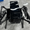
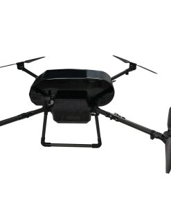
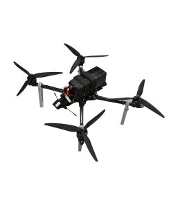
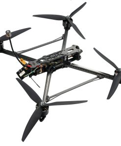
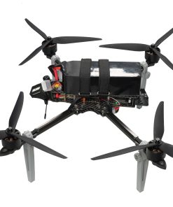
X4-900 Industrial Drone with RTK & Lidar Mapping
$42,880.00
- Centimeter-level RTK accuracy ensures precise automated flights.
- Integrated LiDAR supports versatile high-accuracy mapping missions.
- Up to 52-minute flight time meets extended operational needs.
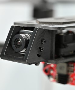
- HD video transmission and gimbal ensure clear and stable imaging.
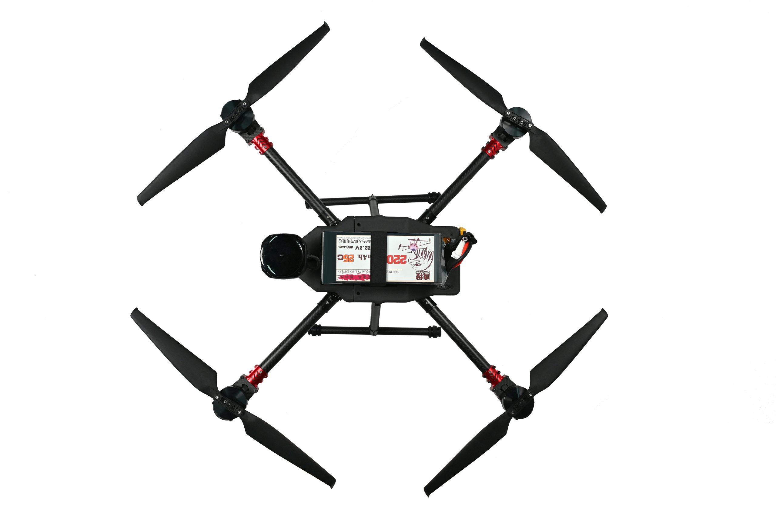
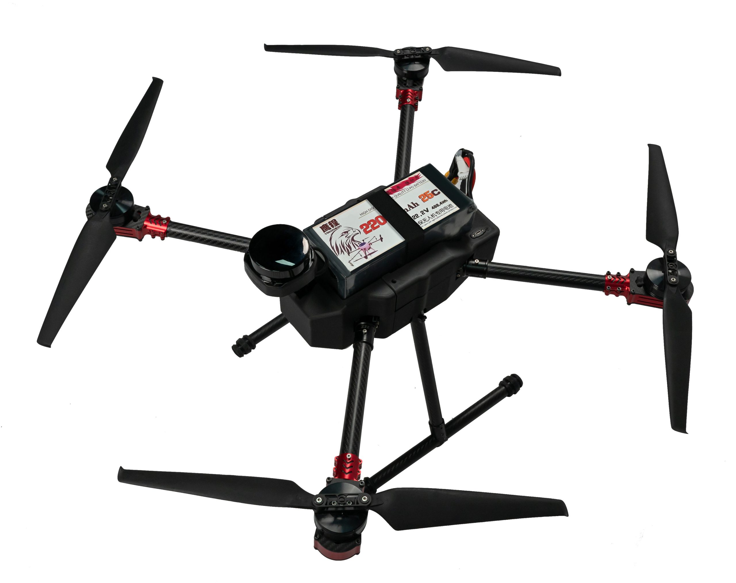
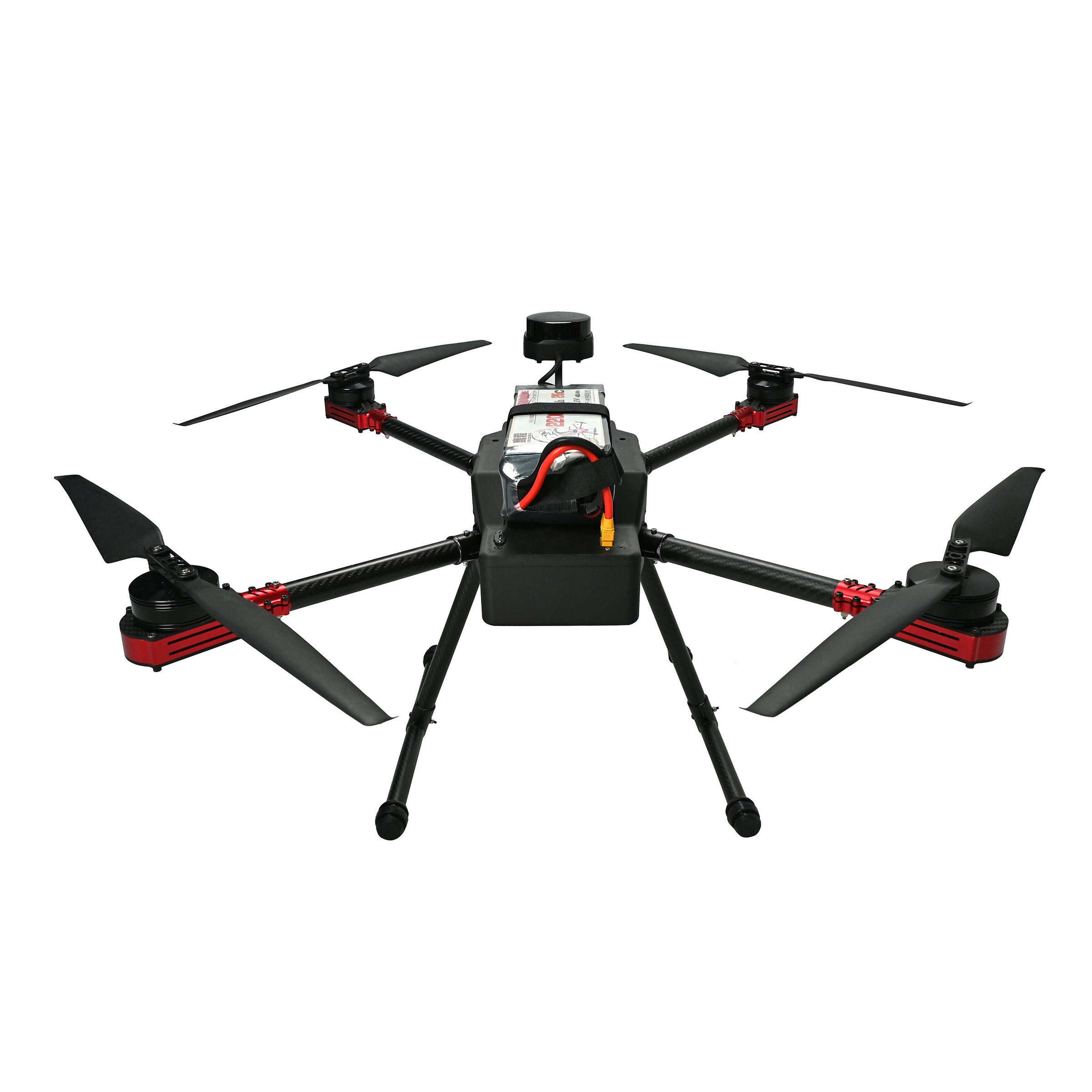
1. Product Overview
The X4-900 is a high-performance drone platform built for industrial applications. It features powerful flight performance, accurate navigation, reliable video transmission, and versatile payload integration.
Key specifications include:
-
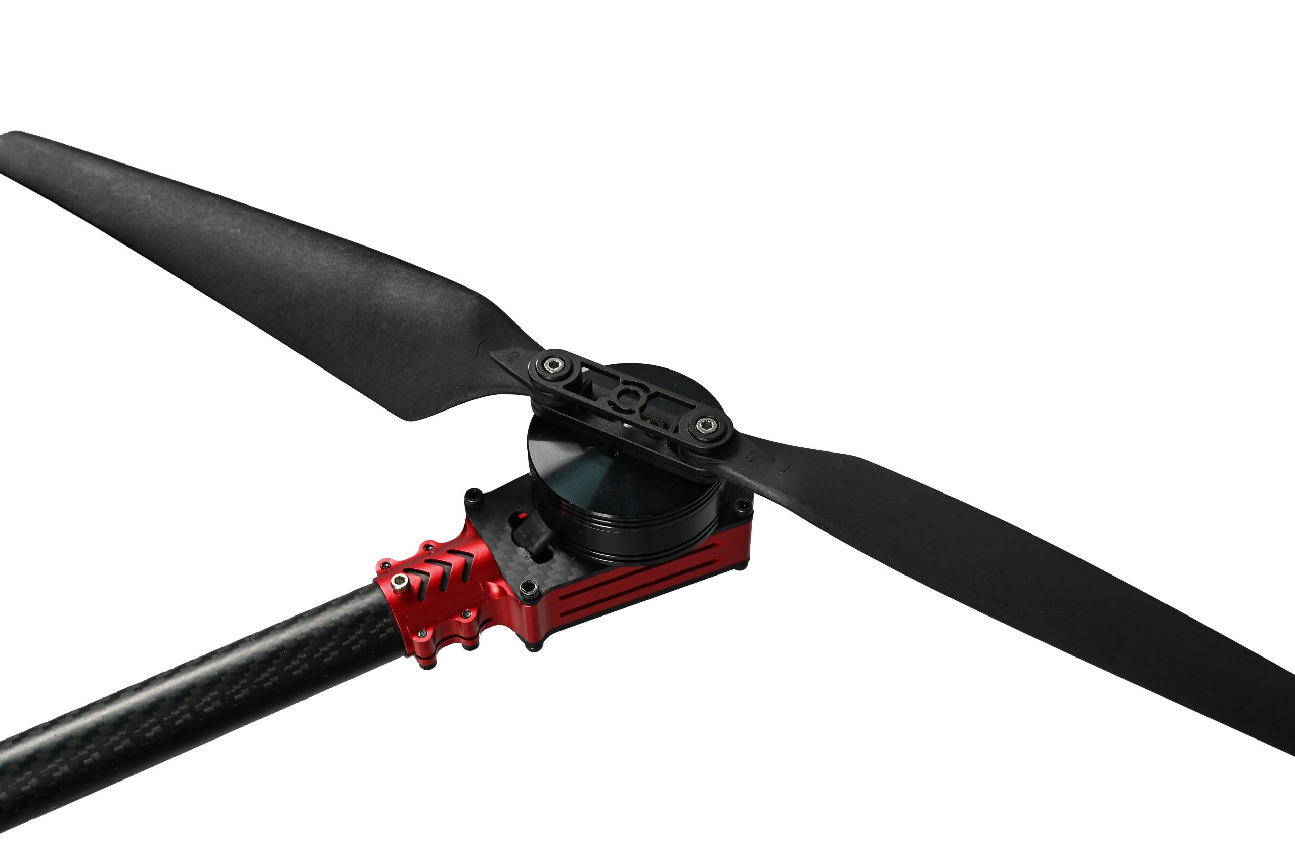
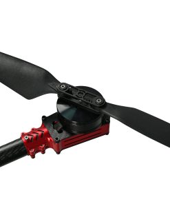
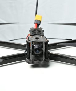
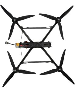
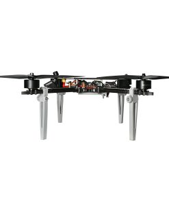
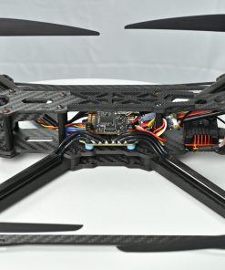
ESC: SE0660X4, high-performance ESC for stable motor operation.
-
Flight Controller: S7mini, advanced control system for precise flight.
-
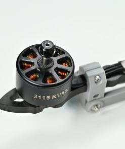
Motor: 5008, powerful and efficient motors.
-
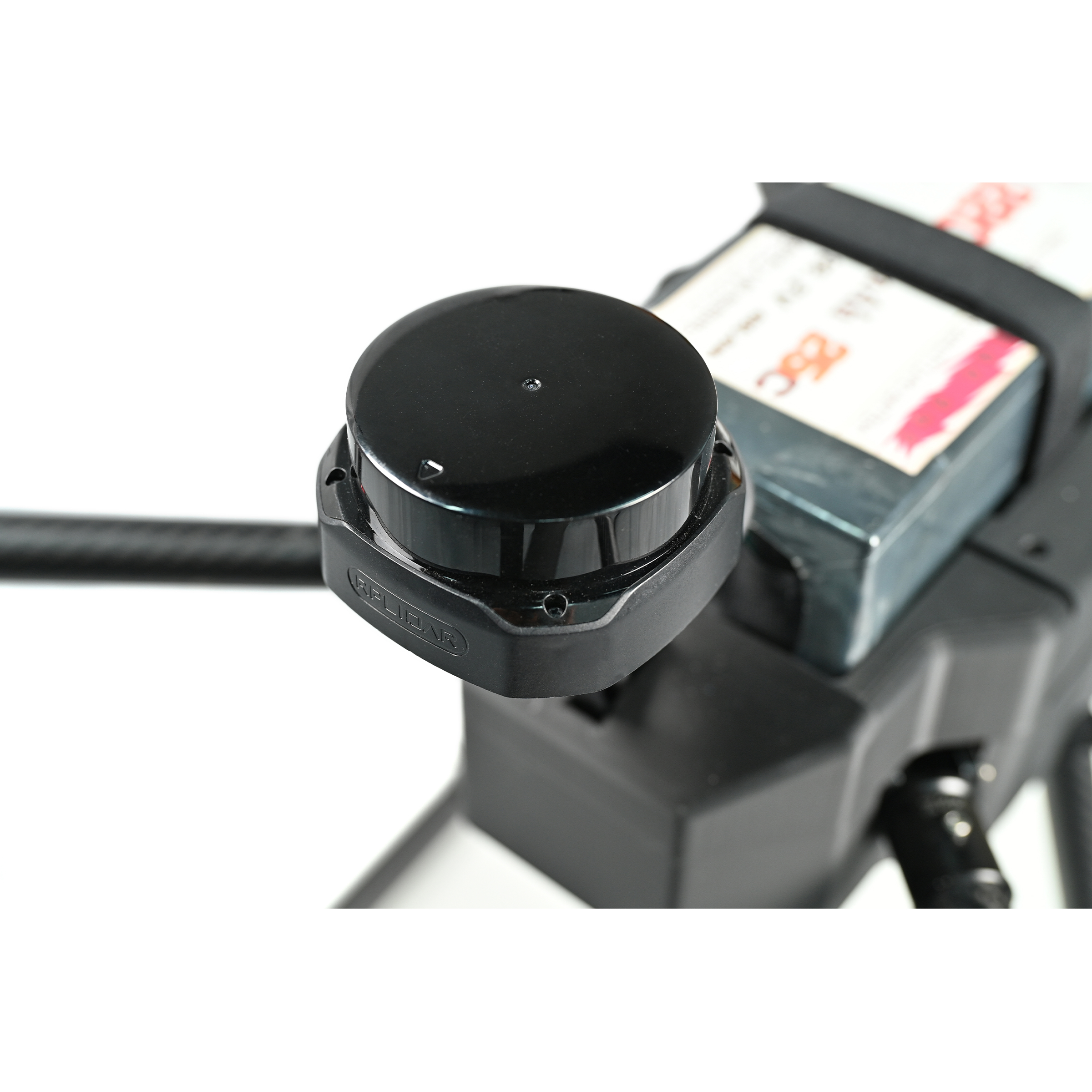
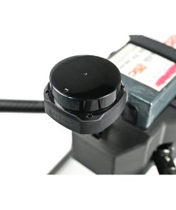
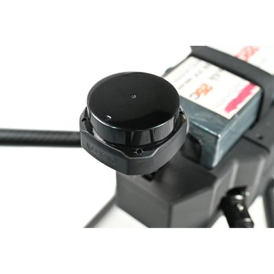
RTK: G982, centimeter-level positioning for accurate routing.
-
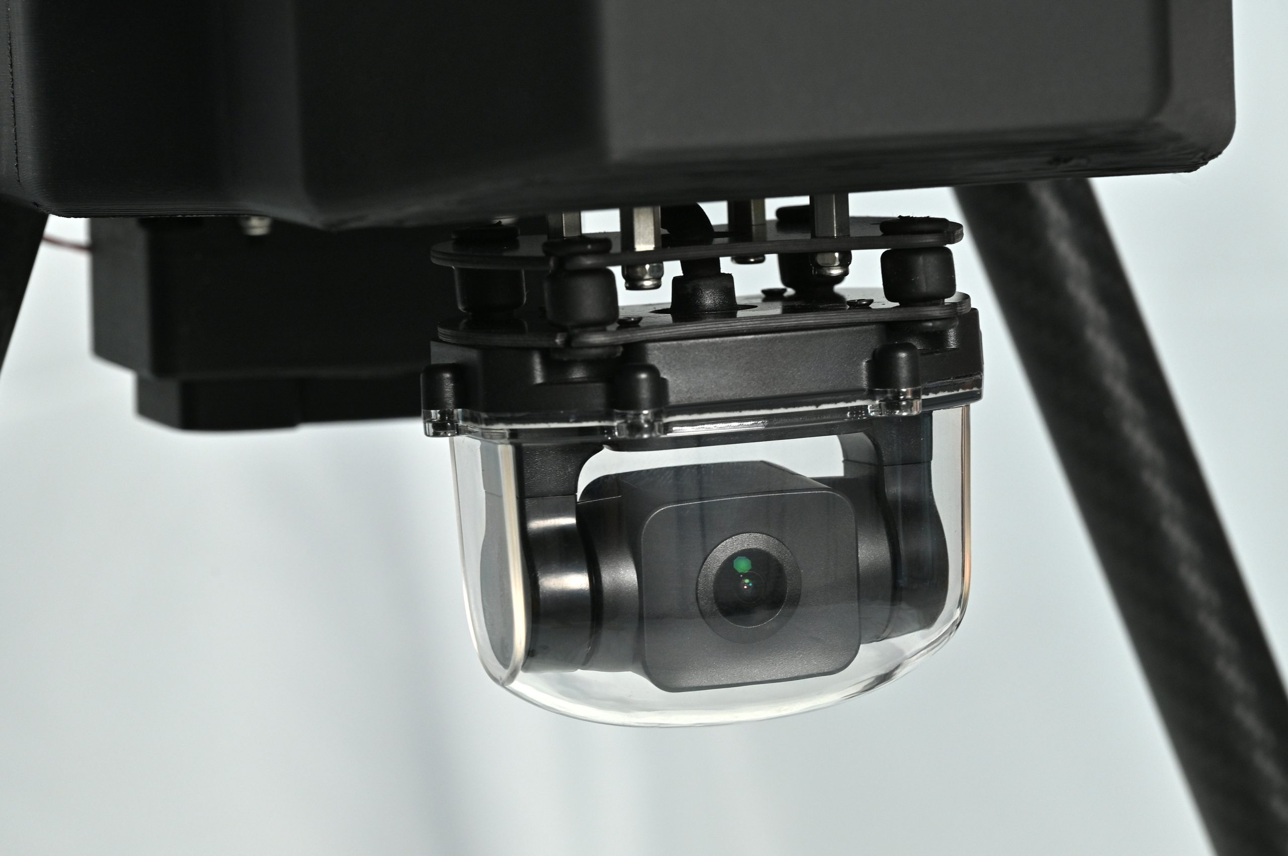
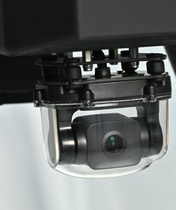
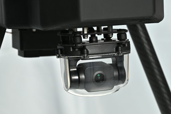
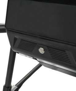
Gimbal: A2MINI, stable gimbal supporting various cameras.
-
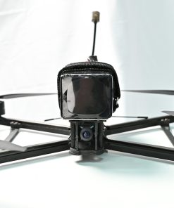
Video Transmission: VW20, long-range HD transmission system.
-
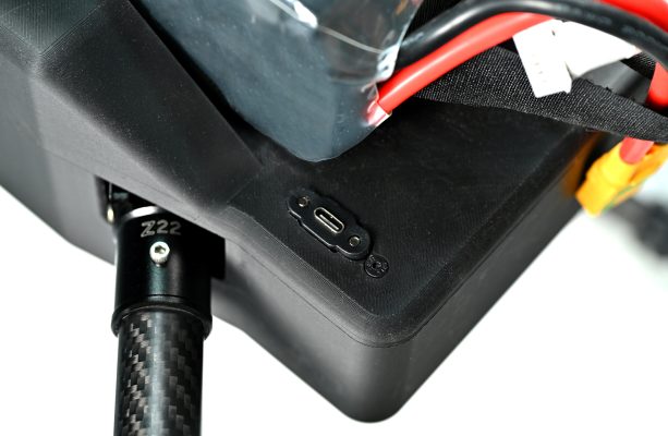
Battery: 6S 22000mAh, long-endurance battery for extended flight.
-
Propellers: 18×5.7, 2 pairs optimized for aerodynamic efficiency.
-
Lidar: SLAMTEC S2, high-precision lidar for mapping tasks.
-
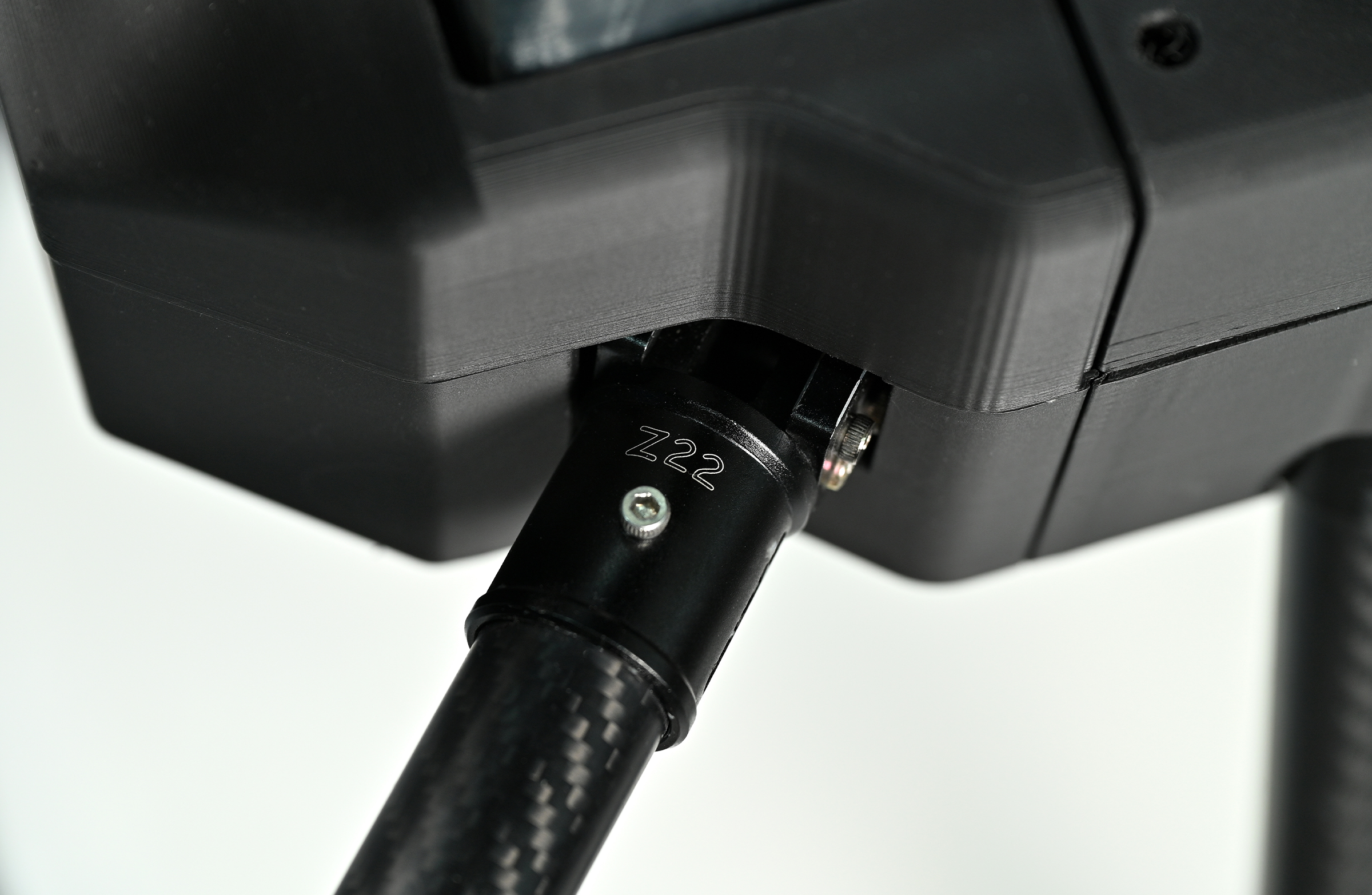
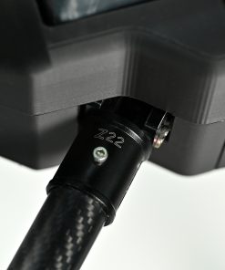
Wheelbase: 900mm, balanced design for stability and agility.
-
Dimensions (w/o propellers): 62×62×40cm, compact and transport-friendly.
-
Max Cruising Speed: 18m/s
-
Endurance: Up to 52 minutes (unloaded)
2. System Highlights
Flight System:
-
Combined SE0660X4 ESC and 5008 motors provide efficient and stable propulsion.
-
S7mini FC supports automated takeoff/landing/return, enabling smooth and controlled flights.
-
G982 RTK offers centimeter-level precision for high-accuracy tasks.
-
A2MINI gimbal supports a range of sensors, delivering stable and clear footage.
Payload Flexibility:
-
Integrated SLAMTEC S2 LiDAR delivers millimeter-level measurement accuracy, supporting terrain scanning, 3D modeling, and more.
-
22000mAh battery offers up to 52 minutes of flight, reducing interruptions.
-
18×5.7 propellers optimize lift and power efficiency.
Communication and Monitoring:
-
VW20 provides HD transmission over several kilometers (depending on conditions).
-
Real-time feed of video, flight data, and sensor info keeps operators fully informed.
Portability and Reliability:
-
Compact design (62×62×40cm) is easy to transport and deploy.
-
Built from premium materials with rigorous QA, it’s engineered for reliability in field environments.
3. Application Scenarios
Surveying & Mapping:
-
High-resolution terrain data generation with RTK and LiDAR integration.
-
Supports DTM/DSM creation for urban planning, construction, and land management.
Powerline Inspection:
-
Real-time HD imagery and RTK-guided paths streamline infrastructure checks.
-
Easily navigates mountainous and forested regions for continuous inspection.
Security & Monitoring:
-
Long-range video streaming enables wide-area surveillance.
-
Compatible with night-vision modules for 24/7 operation.
4. Pre-Sales FAQs
Q: What positioning accuracy does the RTK provide?
A: The G982 RTK module delivers 1–2 cm accuracy under normal conditions—ideal for mapping, inspection, and automated path following.
Q: How accurate is the SLAMTEC S2 lidar?
A: The lidar provides millimeter-grade resolution and is perfect for detailed modeling of terrain, buildings, or vegetation.
Q: Is it difficult to operate?
A: Not at all. With automated flight features and beginner-friendly controls, it’s easy to get started. For professional missions, we provide manuals and training resources to ensure safe operation.
Q: Can 52 minutes of endurance meet real work needs?
A: Yes, for most survey and inspection tasks this is more than sufficient. The battery design minimizes downtime and supports battery-swapping for longer missions.
Q: What about after-sales support?
A: We offer full technical support, remote diagnostics, repair services, and warranty coverage. Our team is ready to assist with training, troubleshooting, and maintenance.
| Dimensions | 62 × 62 × 40 cm |
|---|
3 reviews for X4-900 Industrial Drone with RTK & Lidar Mapping
Add a review
You must be logged in to post a review.
Related products

$5,000.00
$5,871.00
$348,800.00
$5,871.00
FPV Drones
$5,000.00
$5,000.00
$5,871.00
$5,000.00
Anna_Kovacs –
RTK and Lidar integration works flawlessly. We’ve used it for powerline inspection with great success
Diego_Lopez –
Impressed by the stability even under strong wind. Also, the endurance is excellent
Ethan –
Simple to operate for such a professional drone. Perfect for our mapping team