


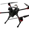
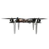
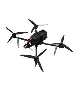
X4-900H RTK Mapping Drone with Lidar and 52-min Flight
$42,880.00
- RTK centimeter-level positioning for accurate flight paths
- Integrated Lidar and HD transmission for real-time data
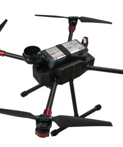
- 6S 22000mAh battery for up to 52 minutes of flight
- Multi-payload support for mapping, inspection, and security
-
Centimeter-level RTK for high-precision routes
-
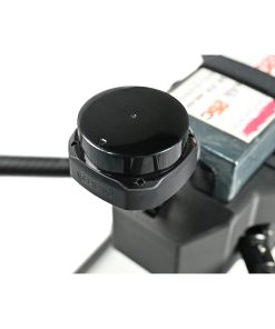
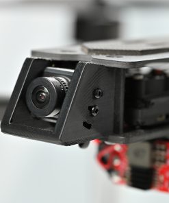
VW20 HD video transmission + Suilan S2 lidar
-
6S 22000mAh battery for 52-min long endurance
-
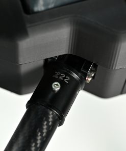
900mm frame with stable and compact design
-
Supports mapping, inspection, and security missions
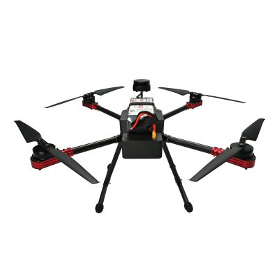
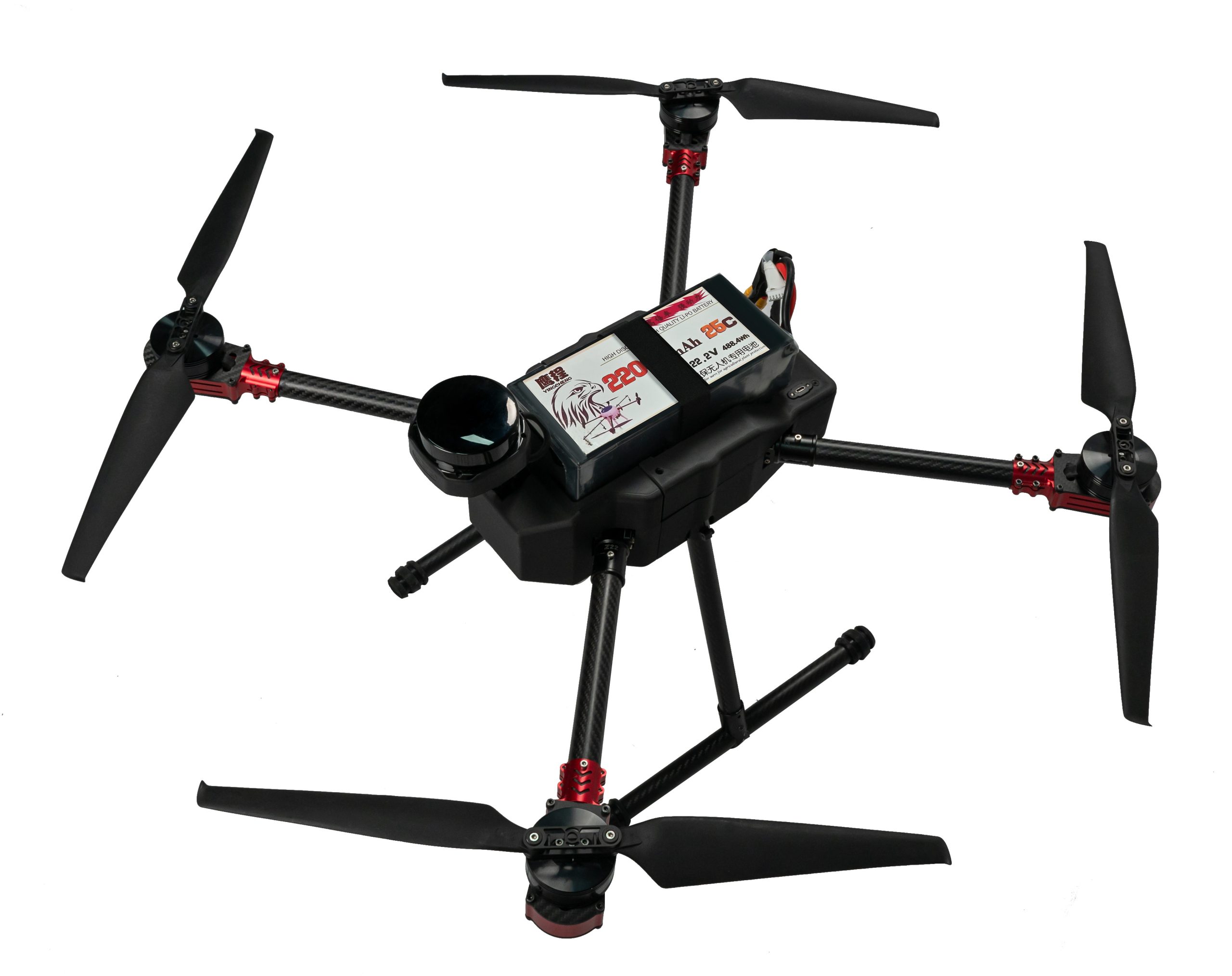
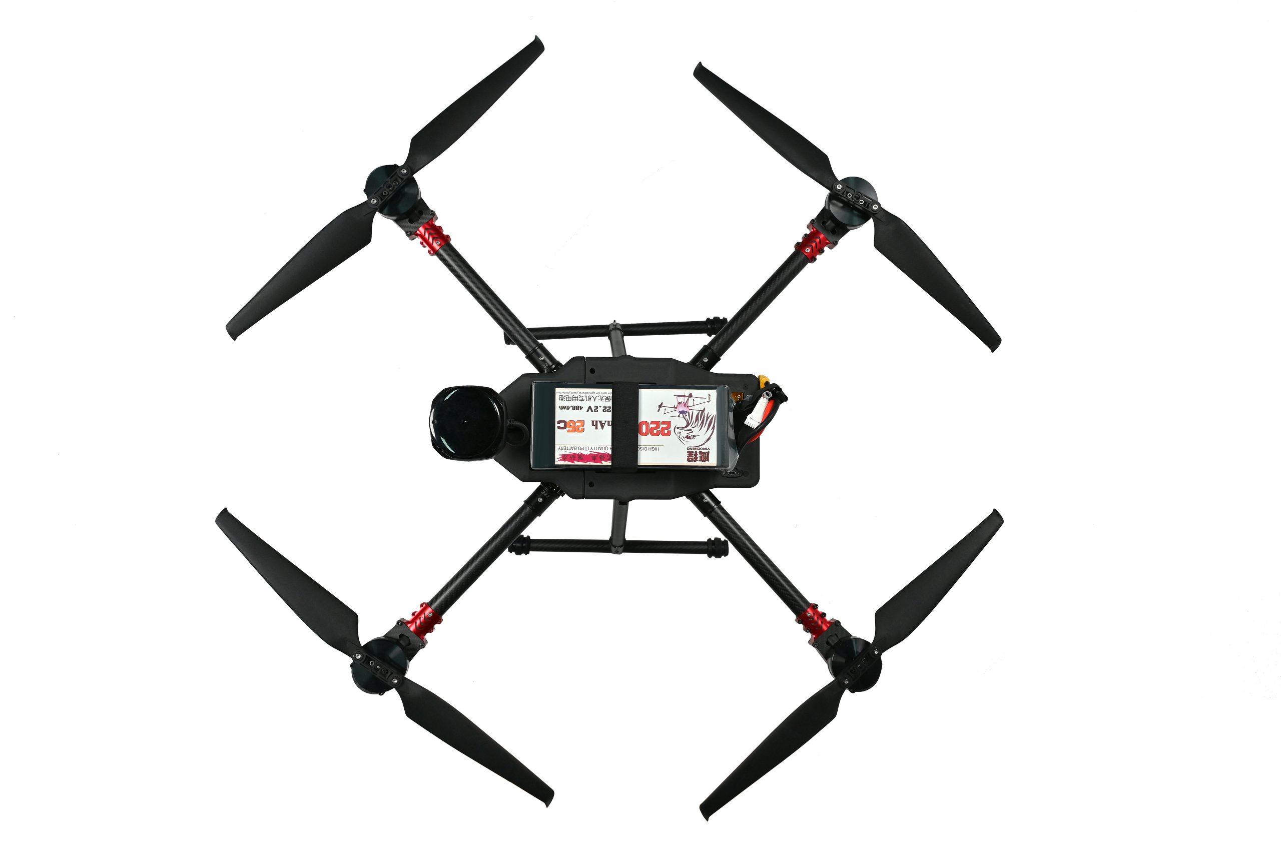
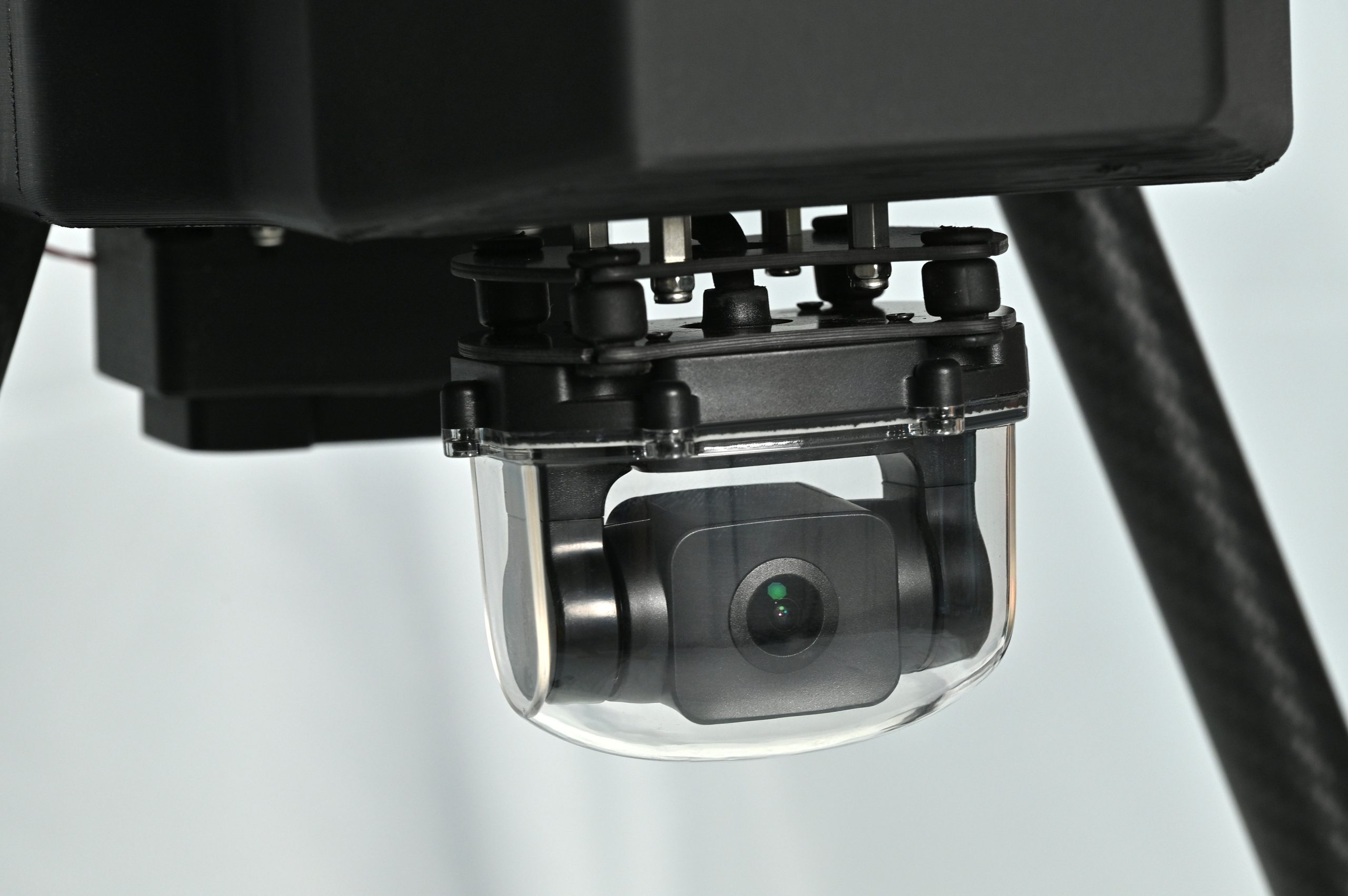
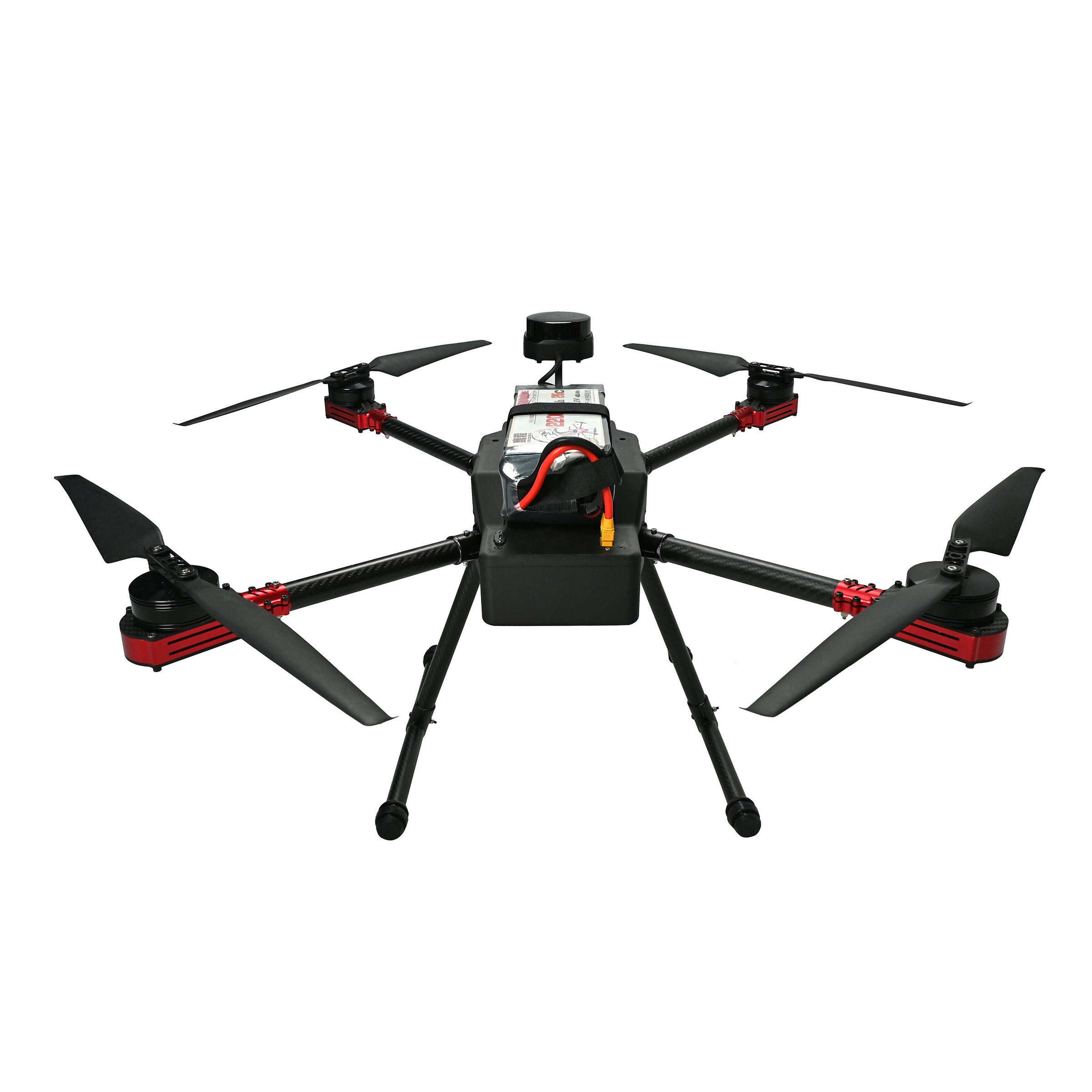
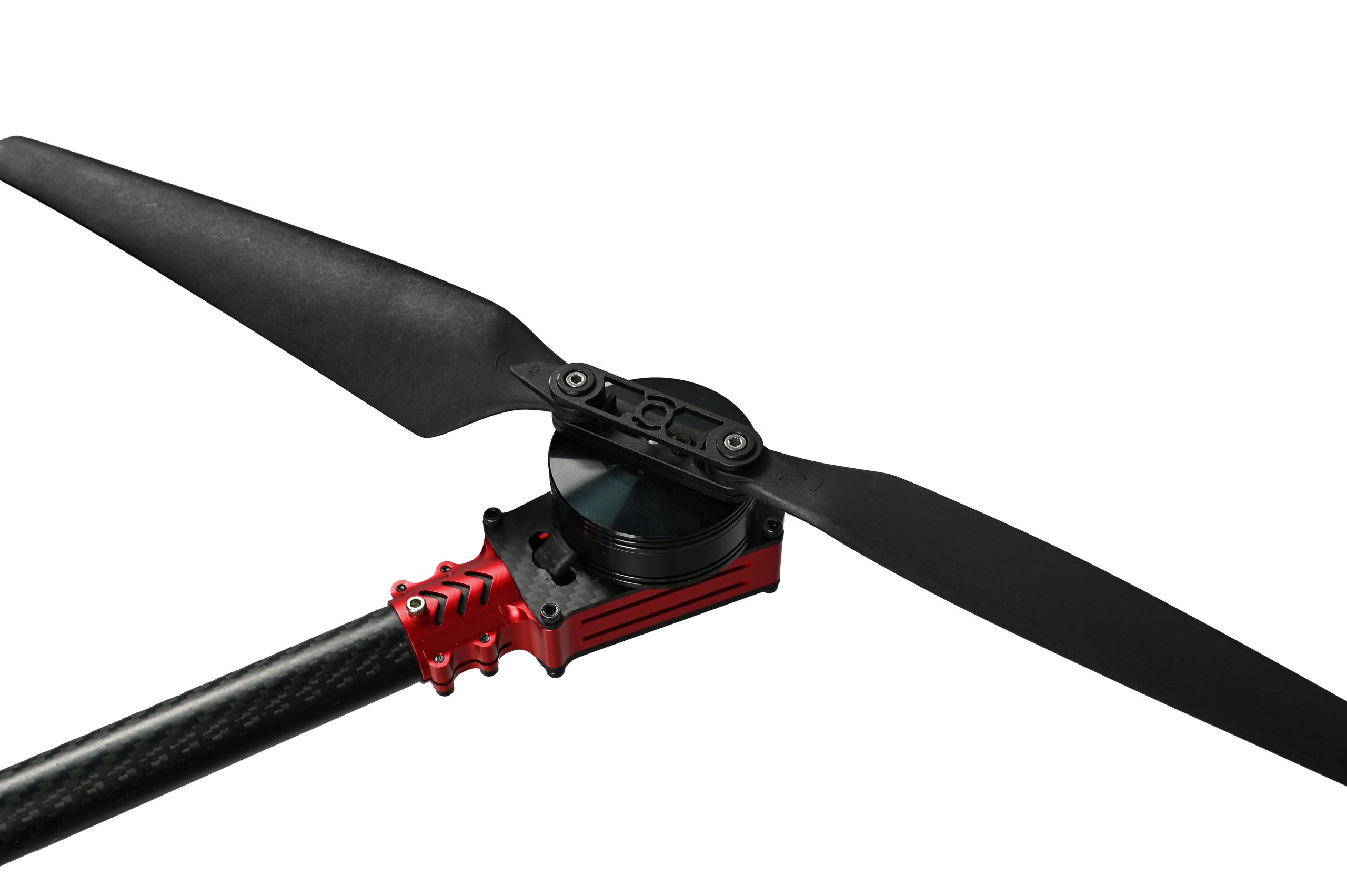
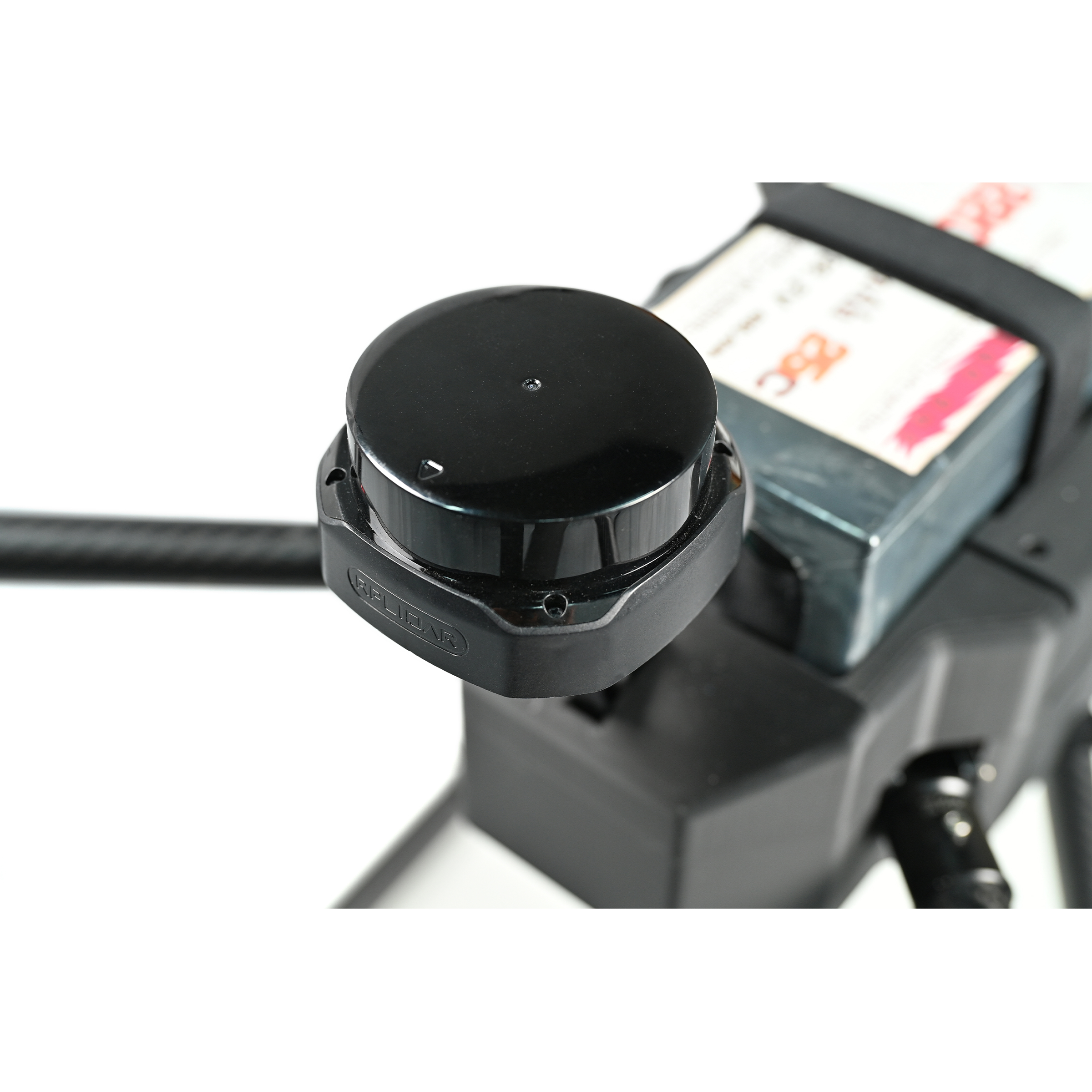
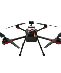
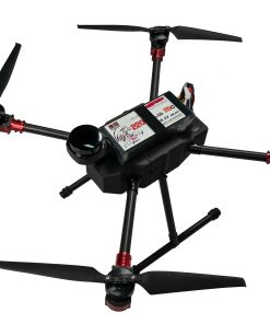
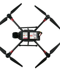
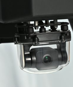
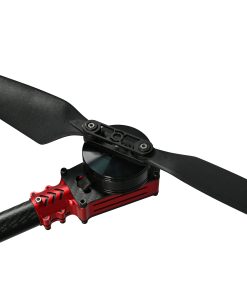
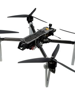
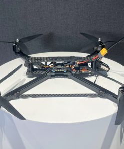
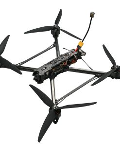
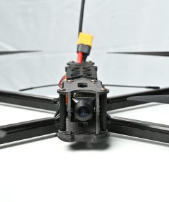
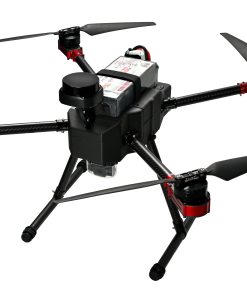
ESC (Electronic Speed Controller) SE0660X4 Flight Controller s7mini Motor 5008 RTK G982 Gimbal A2MINI Transmission Video VW20 Battery 6s 22000mAh Propeller 18*5.7 2 PAIRS LiDAR SLAMTEC S2 Wheelbase 900mm Dimensions (without propellers) Length 62, Width 62, Height 40 Maximum Horizontal Speed 18m/s Flight Time (without payload) 52min The X4-900H is a high-performance drone engineered for industrial-grade mapping, inspection, and surveillance tasks. Featuring centimeter-level RTK positioning (G982), advanced flight control (S7mini), and a stable A2MINI gimbal system, it ensures precision and reliability in every mission.
Equipped with a VW20 HD video transmission system and Suilan S2 lidar, this drone supports high-resolution real-time monitoring and 3D terrain data capture. The 6S 22000mAh battery offers up to 52 minutes of flight time, reducing downtime. Its 900mm wheelbase and 62×62×40cm frame offer optimal balance between portability and flight stability, making it ideal for aerial work in complex environments.The X4-900H industrial drone combines RTK precision, lidar data collection, and real-time video transmission in one compact platform. It uses the G982 RTK system for centimeter-level accuracy, a VW20 HD transmission module, and a Suilan S2 lidar for generating detailed topographic data.
The flight system includes the S7mini flight controller and A2MINI gimbal for stable control. Powered by a 6S 22000mAh battery, the drone supports up to 52 minutes of flight time. With a 900mm wheelbase and compact body (62×62×40cm), it is easily transportable and deployable across terrain for mapping, power inspections, and surveillance.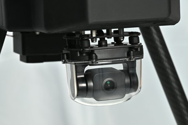
| Dimensions | 62 × 62 × 40 cm |
|---|
3 reviews for X4-900H RTK Mapping Drone with Lidar and 52-min Flight
Add a review
You must be logged in to post a review.
Related products


FPV Drones
fifthy –
RTK and Lidar integration makes mapping super accurate.
dalin –
I can fly for nearly an hour with full control.
timi –
Real-time video and data transmission are a big plus