Description Catalog Quality control Related FAQ Reviews


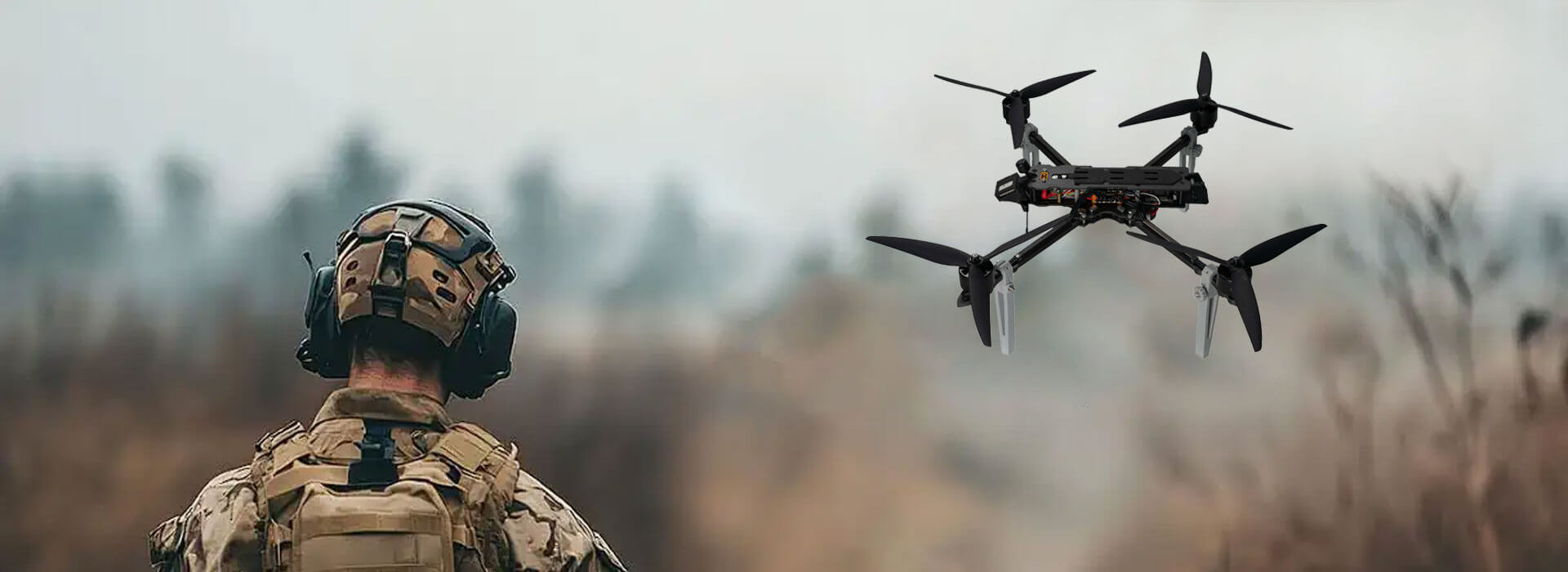
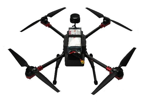
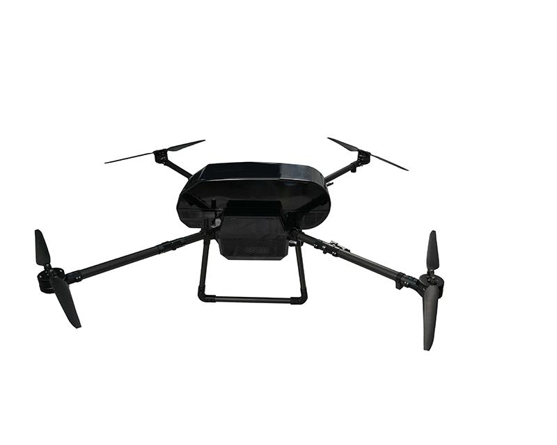
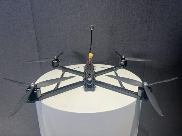
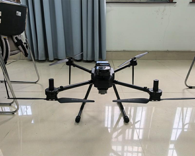
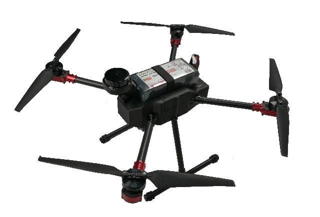
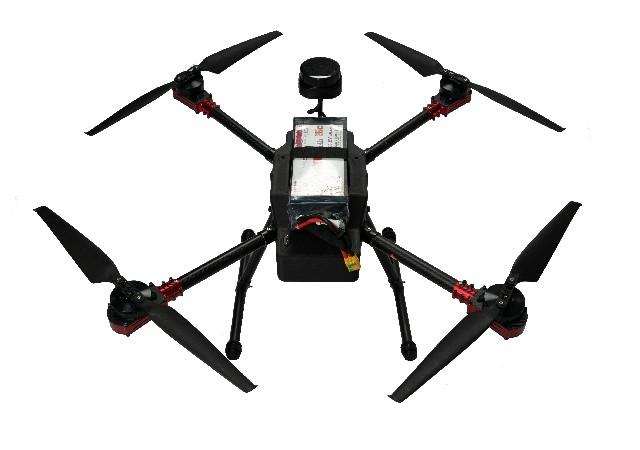
X4-900 Industrial Drone with RTK & Lidar Mapping

Price: $
Model: x4-900
Wheelbase: 900mm
Flight Control: s7mini
Empty Weight: 18m/s
Power Battery: 6s 22000mAh
Wingspan(without propellers): Length 62, Width 62, Height 40
Folded Size(without propellers):
Empty Weight:
Satellite Navigation System:
Endurance Time: 52min
Maximum Horizontal Speed: 18m/s
Image Transmission: VW20
Electronic Speed Controller: SE0660X4

Get Quote


1. Product Overview

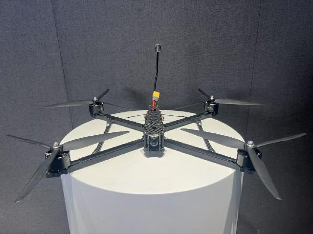
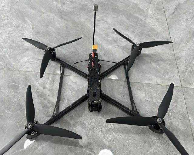
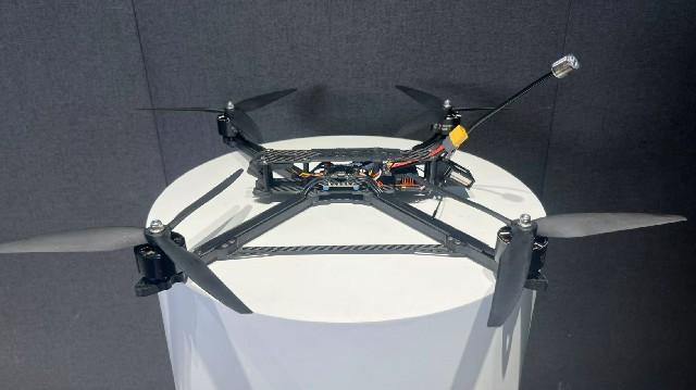
The X4-900 is a high-performance drone platform built for industrial applications. It features powerful flight performance, accurate navigation, reliable video transmission, and versatile payload integration.
Key specifications include:

  • ESC: SE0660X4, high-performance ESC for stable motor operation.

  • Flight Controller: S7mini, advanced control system for precise flight.

  • Motor: 5008, powerful and efficient motors.

  • RTK: G982, centimeter-level positioning for accurate routing.

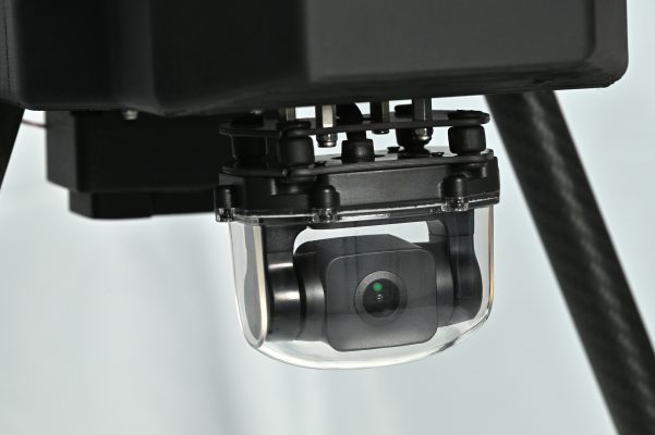
  • Gimbal: A2MINI, stable gimbal supporting various cameras.

  • Video Transmission: VW20, long-range HD transmission system.

  • Battery: 6S 22000mAh, long-endurance battery for extended flight.

  • Propellers: 18×5.7, 2 pairs optimized for aerodynamic efficiency.

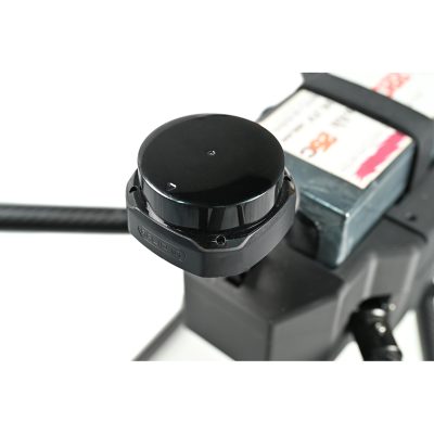
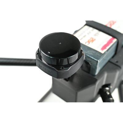
  • Lidar: SLAMTEC S2, high-precision lidar for mapping tasks.

  • Wheelbase: 900mm, balanced design for stability and agility.

  • Dimensions (w/o propellers): 62×62×40cm, compact and transport-friendly.

  • Max Cruising Speed: 18m/s

  • Endurance: Up to 52 minutes (unloaded)

2. System Highlights

Flight System:

  • Combined SE0660X4 ESC and 5008 motors provide efficient and stable propulsion.

  • S7mini FC supports automated takeoff/landing/return, enabling smooth and controlled flights.

  • G982 RTK offers centimeter-level precision for high-accuracy tasks.

  • A2MINI gimbal supports a range of sensors, delivering stable and clear footage.

Payload Flexibility:

  • Integrated SLAMTEC S2 LiDAR delivers millimeter-level measurement accuracy, supporting terrain scanning, 3D modeling, and more.

  • 22000mAh battery offers up to 52 minutes of flight, reducing interruptions.

  • 18×5.7 propellers optimize lift and power efficiency.

Communication and Monitoring:

  • VW20 provides HD transmission over several kilometers (depending on conditions).

  • Real-time feed of video, flight data, and sensor info keeps operators fully informed.

Portability and Reliability:

  • Compact design (62×62×40cm) is easy to transport and deploy.

  • Built from premium materials with rigorous QA, it’s engineered for reliability in field environments.

3. Application Scenarios

Surveying & Mapping:

  • High-resolution terrain data generation with RTK and LiDAR integration.

  • Supports DTM/DSM creation for urban planning, construction, and land management.

Powerline Inspection:

  • Real-time HD imagery and RTK-guided paths streamline infrastructure checks.

  • Easily navigates mountainous and forested regions for continuous inspection.

Security & Monitoring:

  • Long-range video streaming enables wide-area surveillance.

  • Compatible with night-vision modules for 24/7 operation.

4. Pre-Sales FAQs

Q: What positioning accuracy does the RTK provide?
A: The G982 RTK module delivers 1–2 cm accuracy under normal conditions—ideal for mapping, inspection, and automated path following.

Q: How accurate is the SLAMTEC S2 lidar?
A: The lidar provides millimeter-grade resolution and is perfect for detailed modeling of terrain, buildings, or vegetation.

Q: Is it difficult to operate?
A: Not at all. With automated flight features and beginner-friendly controls, it's easy to get started. For professional missions, we provide manuals and training resources to ensure safe operation.

Q: Can 52 minutes of endurance meet real work needs?
A: Yes, for most survey and inspection tasks this is more than sufficient. The battery design minimizes downtime and supports battery-swapping for longer missions.

Q: What about after-sales support?
A: We offer full technical support, remote diagnostics, repair services, and warranty coverage. Our team is ready to assist with training, troubleshooting, and maintenance.


  1. Centimeter-level RTK accuracy ensures precise automated flights.
  2. Integrated LiDAR supports versatile high-accuracy mapping missions.
  3. Up to 52-minute flight time meets extended operational needs.
  4. HD video transmission and gimbal ensure clear and stable imaging.

Related Products

More》

Related Resource


X4-900 Industrial Drone with RTK & Lidar MappingRelated Quality Control
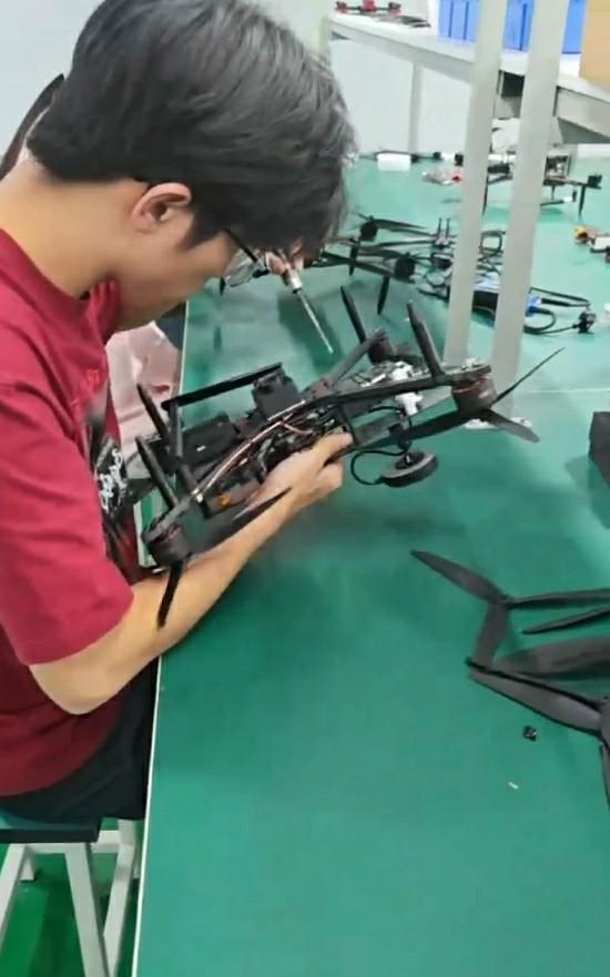
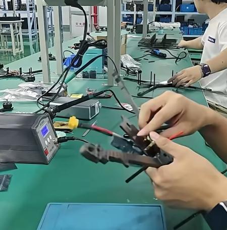
Careful Selection and Inspection of All Incoming Electronic and Mechanical Components
All electronic and mechanical components undergo meticulous inspection upon arrival, including performance testing and material verification. By selecting only premium-grade parts, we prevent potential defects and ensure that every component contributes to the drone’s stability, responsiveness, a
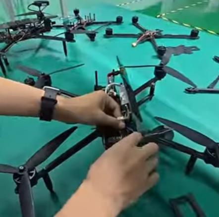
Flight Performance Testing to Verify Stability and Responsiveness
We conduct comprehensive flight performance tests simulating tactical maneuvers and extreme operational conditions. By evaluating stability, acceleration, agility, and responsiveness, we ensure each FPV drone can perform reliably under high-speed, long-distance, or combat-simulation scenarios, meeti
Endurance and Vibration Testing for Key Structural Components
Critical components, including frames, motors, and power systems, undergo endurance and vibration testing to confirm durability. This ensures that structural elements can withstand prolonged flights, high-speed maneuvers, and exposure to vibrations and shocks typical in military or tactical applic
Batch Tracking and Traceability for Quality Assurance
We implement full batch tracking and traceability systems for all components and finished products. This allows us to trace the production history, monitor quality trends, and provide fast, reliable support for any post-sale issues, ensuring operational confidence and accountability for every FPV
Related FAQ
FAQ More+
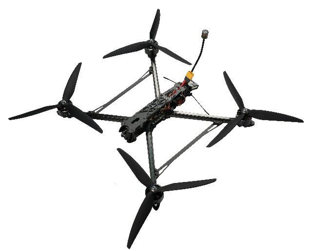
1.How Far and How Long Can a Long Range FPV Drone Fly?
Flight time and range depend on multiple factors, including battery capacity, flying speed, weather conditions, and payload weight. Under standard conditions, long-range FPV drones can achieve flight times of up to 30 minutes . Actual performance may vary if the drone is flown aggressively or in ...
2.How is stable communication maintained over long distances for FPV drones?
Reliable communication is critical for long-range FPV missions. The Long Range FPV Drone employs a 915MHz receiver and advanced telemetry system to maintain a stable, interference-resistant link between the drone and the pilot. This ensures real-time transmission of flight data, including altitude,...
3.How durable and field-maintainable are Long Range FPV drones for extended missions?
Durability and maintainability are essential for long-range professional operations. The Long Range FPV Drone features a lightweight yet reinforced frame that can withstand turbulent conditions, minor collisions, and extended flight stress. Modular components, including ESCs, motors, and propellers...
4.How does precise flight control support long-range mission success?
Long-range operations require exceptional control and responsiveness. The Long Range FPV Drone integrates INAV and BETAFLIGHT flight controllers to offer pilots the flexibility to adapt to mission needs. INAV provides GPS-assisted navigation and advanced sensor fusion, maintaining accurate position...

Customer Reviews


Score
 Remove

Review Title

Review Text

   Confidence-Boosting Long-Range Flights


 2025-12-30

This long-range FPV drone gives me real confidence when flying far from the launch point. Signal penetration remains stable over open terrain, and the video feed stays clear enough to judge distance and orientation accurately. With proper battery planning, I can comfortably explore wide areas and s
   Awesome Long Range FPV Footage


 2025-12-30

I mounted a lightweight camera on my Long Range FPV and got stunning FPV footage over open fields and trails. The signal stayed strong over long distances, and the build held up well to minor bumps. Definitely a great rig for scenic long flights
   Durable Long-Range Cruiser


 2025-12-30

This long range FPV drone surprised me with its durability. After several long flights and minor crashes, the frame still holds up well. Repairs are easy, and spare parts are easy to find. Great for anyone who loves exploring far beyond the usual FPV range
   Perfect for Wide-Area Exploration


 2025-12-30

I regularly fly over fields and forest trails, and this long range FPV drone never disappoints. The signal range is excellent, and it’s stable even in moderate winds. It’s become my go-to for remote adventure flights and scenic FPV clips
Need Help?
Please leave your contact information to get our latest catalog
Get In Touch Now >
FD FPV Drones

Tel: +86-13959965075

Email: info@fpvdroneskit.com

MP/WhatsApp: +86-13959965075

Manufacturer Address:Quanzhou Valley Nanan Science and Technology Innovation Center, No. 89 Shijing Avenue, Shijing Town, Nanan City, Fujian Province

NEW KEYWORD

About Us

Products

Information

  • tel
  • +86-13959965075
  • Please Leave Message

    Quanzhou XIYI Technology Co., Ltd.
    +86-13959965075
  • info@fpvdroneskit.com
  • whatsapp
    WhatsApp