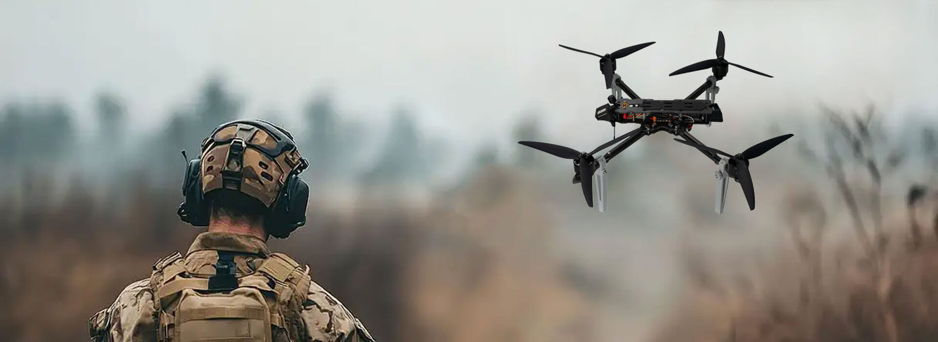
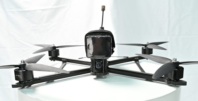
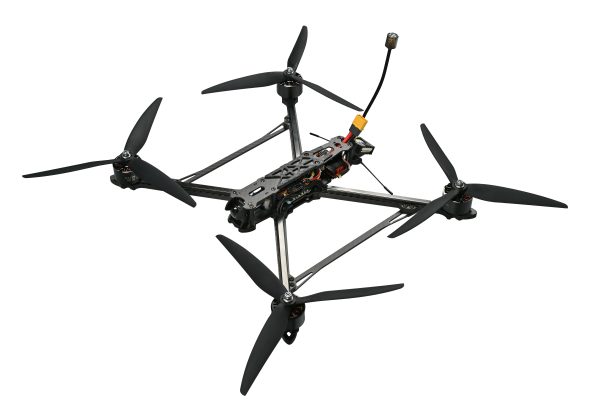
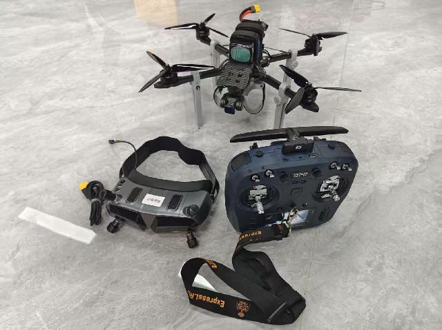
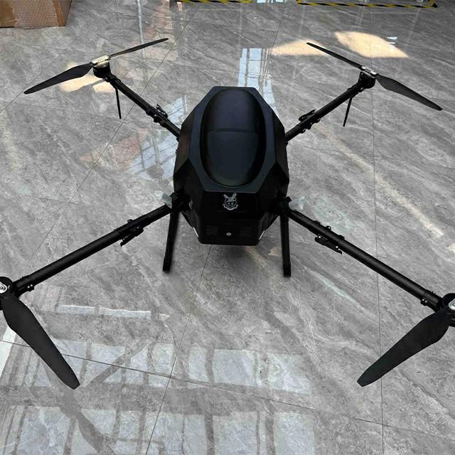
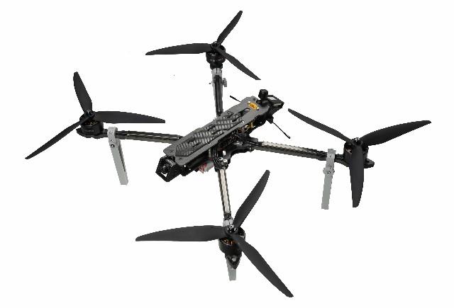
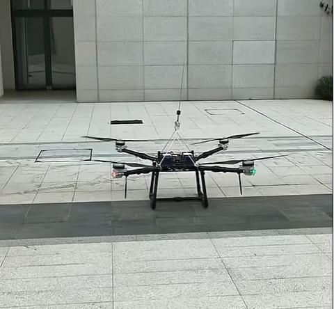
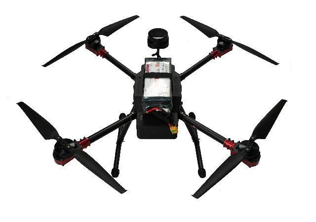
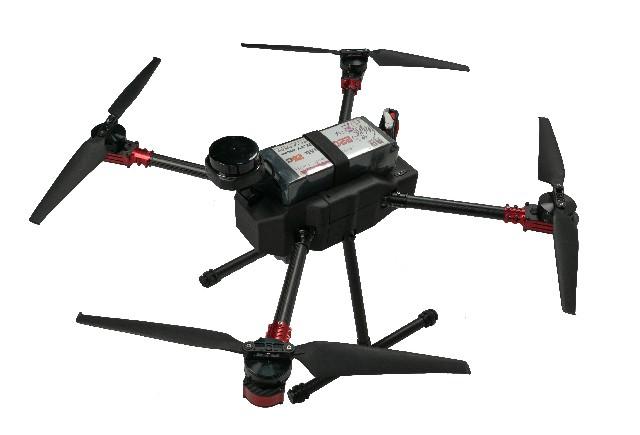
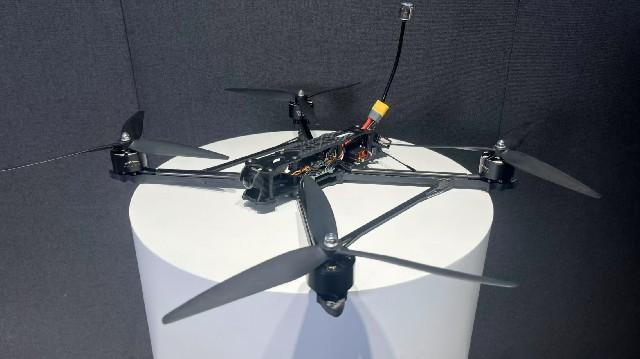
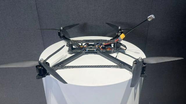
The X4-900 stands as a high-performance drone platform engineered specifically for industrial-grade operations. It integrates robust flight capabilities, pinpoint navigation, reliable long-range video transmission, and flexible payload compatibility to meet the demands of professional workflows.
Key Specifications:
-
ESC: SE0660X4 high-performance electronic speed controller, ensuring steady motor operation even under heavy loads.
-
Flight Controller: S7mini advanced system, enabling precise flight maneuvers and automated operations.
-
Motor: 5008 brushless motors, delivering powerful thrust with exceptional energy efficiency.
-
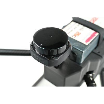
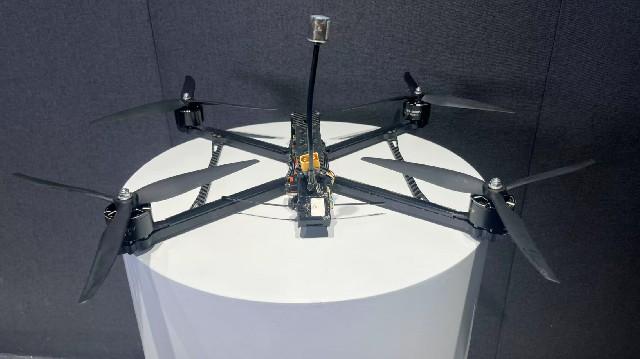
RTK Module: G982, providing centimeter-level positioning for error-free route planning.
-
Gimbal: A2MINI stabilized gimbal, compatible with multiple camera types for steady imaging.
-
Video Transmission: VW20 HD system, supporting long-distance data and video transfer.
-
Battery: 6S 22000mAh high-capacity battery, extending mission duration.
-
Propellers: 18×5.7 aerodynamic propellers (2 pairs), optimized for maximum lift and efficiency.
-
Lidar: SLAMTEC S2 high-precision sensor, designed for detailed mapping and scanning.
-
Wheelbase: 900mm balanced frame, striking a perfect blend of stability and agility.
-
Dimensions (excluding propellers): 62×62×40cm, compact enough for easy transport.
-
Max Cruising Speed: 18m/s
-
Endurance: Up to 52 minutes (unloaded)
Flight System Excellence
The synergy between the SE0660X4 ESC and 5008 motors delivers consistent, efficient propulsion, even in challenging weather. The S7mini flight controller simplifies operations with automated takeoff, landing, and return-to-home functions, ensuring smooth, controlled flights. Paired with the G982 RTK module, it achieves centimeter-level precision—critical for high-accuracy tasks like mapping and inspection. The A2MINI gimbal further enhances data quality, stabilizing cameras and sensors for clear, blur-free footage.
Unmatched Payload Flexibility
Equipped with the SLAMTEC S2 LiDAR, the X4-900 captures millimeter-grade details, ideal for terrain scanning and 3D modeling. Its 22000mAh battery supports up to 52 minutes of flight, minimizing downtime, while the 18×5.7 propellers optimize lift and energy use for extended missions.
Superior Communication & Monitoring
The VW20 transmission system streams HD video and real-time flight data over several kilometers (depending on conditions), keeping operators fully informed. This seamless connectivity ensures precise control and instant access to mission-critical information.
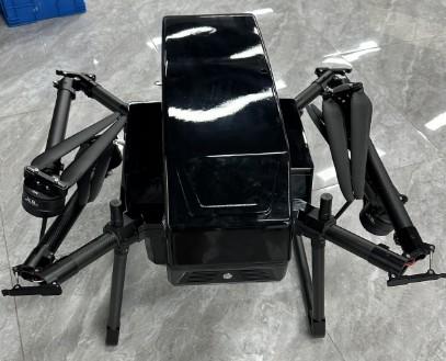
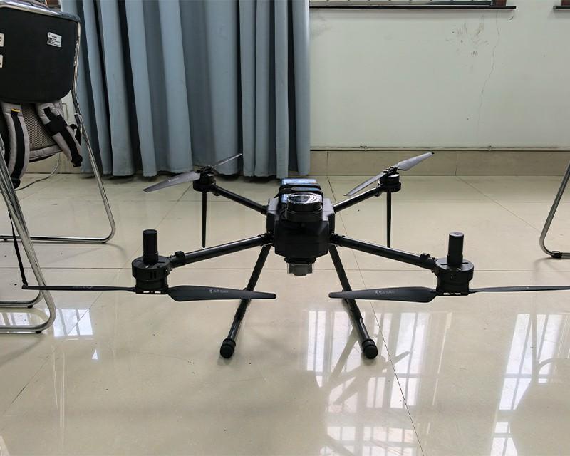
Built for Portability & Durability
With a compact 62×62×40cm design, the X4-900 is easy to transport and deploy in remote locations. Crafted from premium materials and subjected to rigorous quality checks, it’s engineered to withstand harsh field environments, ensuring reliable performance when it matters most.
Surveying & Mapping
Leveraging RTK precision and LiDAR technology, the X4-900 generates high-resolution terrain data, supporting the creation of Digital Terrain Models (DTM) and Digital Surface Models (DSM). It’s an invaluable tool for urban planning, construction site management, and land resource mapping.
Powerline Inspection
Equipped with RTK-guided navigation and real-time HD imaging, it streamlines infrastructure checks. Its agility allows it to navigate mountainous and forested areas with ease, enabling continuous, thorough inspections of power lines and related assets.
Security & Monitoring
The drone’s long-range video streaming capability enables wide-area surveillance, while compatibility with night-vision modules extends operations to 24/7, making it ideal for perimeter security, event monitoring, and emergency response.
Q: What is the positioning accuracy of the RTK module?
A: The G982 RTK module delivers 1–2 cm accuracy under standard conditions, making it perfect for precision-critical tasks like mapping, infrastructure inspection, and automated path following.
Q: How precise is the SLAMTEC S2 LiDAR?
A: The SLAMTEC S2 LiDAR offers millimeter-grade resolution, ensuring detailed modeling of terrain, buildings, vegetation, and other structures—ideal for applications requiring intricate data.
Q: Is the X4-900 difficult to operate?
A: Not at all. It features user-friendly automated flight modes that simplify basic operations, making it accessible to beginners. For professional missions, we provide comprehensive manuals and training resources to ensure safe, efficient use.
Q: Does the 52-minute endurance meet real-world work needs?
A: Yes, for most surveying and inspection tasks, 52 minutes of flight time is more than sufficient. The battery is designed for quick swaps, allowing extended missions with minimal interruptions.
Q: What after-sales support is available?
A: We offer full technical assistance, including remote diagnostics, repair services, and warranty coverage. Our team is also available to provide training, troubleshooting guidance, and maintenance support to keep your operations running smoothly.


 Tel: +86-13959965075
 Email: info@fpvdroneskit.com
 MP/WhatsApp: +86-13959965075
 Manufacturer Address:Quanzhou Valley Nanan Science and Technology Innovation Center, No. 89 Shijing Avenue, Shijing Town, Nanan City, Fujian Province
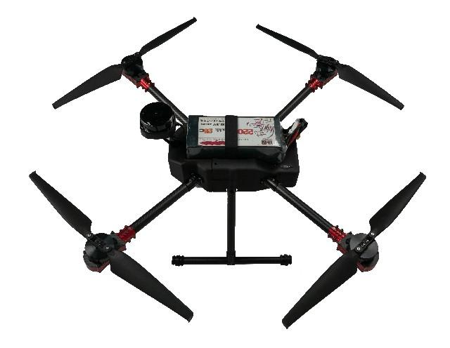


The long-distance capabilities of this drone impressed me right away. It kept a reliable link out to several kilometers, and the sturdy build handled a few rough landings without issue. A solid choice for expansive FPV flights2025-12-30

I’ve tried several FPV drones, and this one stands out for quality and performance. The build feels solid, and the video feed is crystal clear. Definitely recommended for serious hobbyists.2025-12-29
My experience with the FPV Drone has been positive overall. The long-range capability is solid for cruising and exploration flights, and the stable flight characteristics in crosswinds give me confidence flying farther out. Perfect for intermediate pilots looking to push their limits2025-12-30
Long range FPV is incredibly fun, but you need to know what you’re doing. With proper setup and antenna orientation, you can push distances further. I lost signal once flying too quick without checking wind — lesson learned!2025-12-30