Description Catalog Related Cases FAQ Reviews
YOUR POSITION:HOME > DRONES & Kits > Patrol UAV >


4T Patrol UAV Drone With Thermal Imaging Telephoto and Wide Angle Lenses

Price: 8228$
Model: 4T civil inspection evidence
Wheelbase: Archived folded: 250 × 150 × 145mm
Flight Control: Flight controller identity not stated in retained source
Empty Weight: Archived maximum take-off mass: 1900g
Power Battery: Archived battery: 4S 9500mAh
Wingspan(without propellers): Controller: 5.5-inch 1920 × 1080 display
Folded Size(without propellers): Operating range entries require configured validation
Empty Weight: Aircraft, gimbal, camera and controller interfaces must be itemized
Satellite Navigation System: Archived aircraft mass: 1500g
Endurance Time: Current aviation, privacy and radio requirements apply
Maximum Horizontal Speed: Archived maximum take-off mass: 1900g
Image Transmission: Wide, telephoto and 640 × 512 thermal camera record
Electronic Speed Controller: Controller, navigation and RTK revisions require confirmation

Get Quote
4T civil inspection evidence

Evaluate the 4T patrol UAV as a lawful inspection data system

The 4T page should function as a civil inspection evidence sheet. Airframe, visible and thermal channels, controller region, installed mass and dated acceptance conditions remain distinct records. The archive describes a foldable 4T aircraft at 1500g, 1900g maximum take-off mass, 4S 9500mAh battery and up to 53 minutes in windless conditions. It lists a 48MP telephoto camera, 48MP wide camera, 640 × 512 thermal sensor, three-axis gimbal, multi-constellation navigation, RTK and a 5.5-inch controller. Its 45km maximum-range entry is a flight-range statement, not the control or video link: those are separately listed as 15km FCC and 8km CE/SRRC/MIC. All three depend on delivered region, radio hardware, antennas, environment and test method. Altitude, wind and accuracy figures also remain source claims until model identity and configured civil-inspection evidence are supplied.

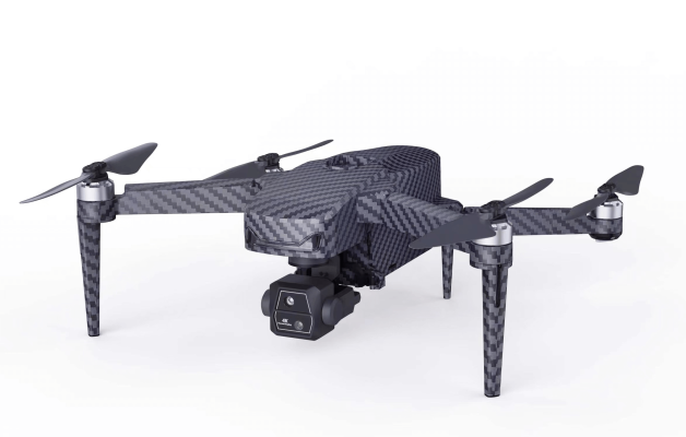
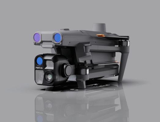
Low-front rendering of the unfolded 4T aircraft with its suspended camera module and paired forward sensor windows visible.
The unfolded rendering shows the airframe and sensor arrangement only; camera identity, thermal calibration, mass and endurance need delivered-unit evidence.
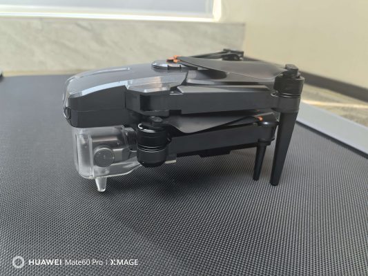
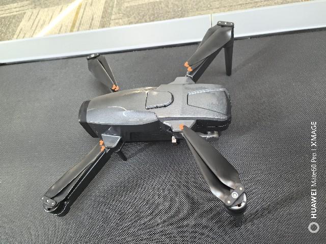
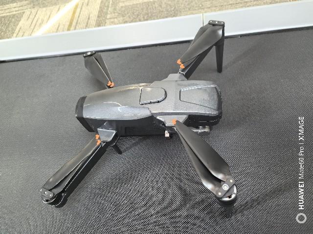
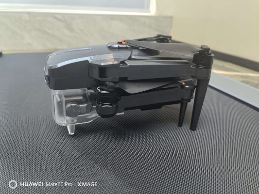
Studio rendering of the 4T aircraft folded for transport, resting on its camera housing with the front sensor pair exposed.
This folded configuration helps assess storage geometry and sensor clearance, not RTK state, regional link performance or inspection accuracy.

4T civil acceptance plan

  1. Verify aircraft, gimbal, camera and controller serials.
  2. Weigh the inspection-ready aircraft and document battery health.
  3. Capture wide, zoom and thermal samples over known references.
  4. Record GNSS or RTK status with every test dataset.
  5. Resolve four-antennas-total versus two-TX-plus-four-RX wording, then run a lawful route with weather, reserve and link evidence.

4T inspection evidence matrix

Inspection decisionArchived valueAcceptance evidence
Aircraft/endurance1500g; 1900g maximum take-off; 4S 9500mAh; 53 minutes windlessSerial, installed equipment, calibrated mass, weather and reserve
Visible/thermal imaging48MP wide and telephoto; 640 × 512 thermal at 30HzOriginal samples, metadata, calibration, emissivity method and reference target
Flight-range recordArchived maximum-range entry: 45kmFlight profile, wind, reserve, local limits and dated configured trial
Control/video link15km FCC; 8km CE/SRRC/MIC; antenna count also conflictsRegion, hardware, antenna inventory, environment, bitrate and link log
NavigationMulti-constellation and RTK wordingCorrection state, coordinate frame, environment and checkpoint evidence

Thermal findings need a repeatable measurement method

For roof, electrical or facility inspection, define target type, viewing distance, angle, emissivity assumption, reflected temperature, palette and reporting threshold. Store radiometric files when supported and compare a known reference; a thermal resolution entry alone does not validate temperature accuracy in the field.
Keep optical and navigation records attached to each dataset

Save original wide, telephoto and thermal files with time, position status, camera settings and operator notes. RTK hover figures require correction status and environment context. Any patrol workflow must respect privacy, site permission and local aviation requirements.

4T inspection procurement questions

Does 53 minutes apply to an inspection payload and route?
No. The archive ties it to windless conditions; validate the delivered sensor setup, weather and reserve.
Can the thermal camera prove temperature by resolution alone?
No. Sensor calibration, emissivity, distance, angle, environment and reference checks affect the result.
What evidence should accompany an inspection sample?
Keep original files, metadata, camera settings, navigation status, weather and operator observations.
Scope a lawful 4T inspection trial

Provide the asset, required outputs and operating constraints to define the dataset and acceptance plan.

Review civil patrol UAV platforms
Field Evidence

4T civil inspection card

Separate flight, visible-light and thermal evidence for the delivered configuration.

01
Record airframe, battery, configured mass and controller region.
02
Identify visible, telephoto and thermal channels with sample-file metadata.
03
Keep route, link, endurance, RTK and radiometric results under dated conditions.

Related Resource


Related Cases SOP Pods Knows All About 4T Patrol UAV Drone With Thermal Imaging Telephoto and Wide Angle Lenses
And Perfect Space for Clear Calls Solutions By Our Experience.
Related FAQ
FAQ More+
1.How long can a patrol UAV remain airborne?
Find evidence-led answers about FPV configuration, compatibility, documentation and acceptance checks for lawful decisions....
2.Are patrol UAVs suitable for continuous daily operations?
Find evidence-led answers about FPV configuration, compatibility, documentation and acceptance checks for lawful decisions....
3.Can patrol UAVs operate autonomously?
Find evidence-led answers about FPV configuration, compatibility, documentation and acceptance checks for lawful decisions....
4.What payloads are commonly used on patrol UAVs?
Find evidence-led answers about FPV configuration, compatibility, documentation and acceptance checks for lawful decisions....

Customer Reviews


Score
 Remove

Review Title

Review Text

   Accurate GPS and Waypoint Navigation


 2025-12-30

The GPS positioning and waypoint navigation are precise. Once programmed, the UAV follows patrol routes accurately with minimal manual input.
   Stable Performance in Challenging Weather


 2025-12-30

This UAV remains stable in moderate wind and light rain. The consistent performance makes it reliable for outdoor patrol tasks under changing conditions
   Thermal Camera Performance Exceeded Expectations


 2025-12-29

The thermal imaging on this patrol UAV is incredibly sharp, even in low‑light conditions. We regularly use it for night security checks and it delivers reliable results with minimal noise
   Durable Build for Frequent Use


 2025-12-30

The airframe feels solid and well-built. After repeated takeoffs and landings, it still performs reliably, making it suitable for frequent patrol operations
Need Help?
Please leave your contact information to get our latest catalog
Get In Touch Now >
FD FPV Drones

Tel: +86-13959965075

Email: info@fpvdroneskit.com

MP/WhatsApp: +86-13959965075

Manufacturer Address:Quanzhou Valley Nanan Science and Technology Innovation Center, No. 89 Shijing Avenue, Shijing Town, Nanan City, Fujian Province

NEW KEYWORD

About Us

Products

Information